
ODE Selection of Interactive Atlases
An interactive atlas refers to a digital or online mapping tool that allows users to explore and interact with geographical information. The goal is to provide a more engaging and flexible way for users to explore and understand geographical data.
Coral Reef Watch (NOAA)NOAA Coral Reef Watch (CRW) has been using remote sensing, modeled, and in situ data to operate a decision support system to help resource managers (our target audience), researchers, decision makers, and other stakeholders around the world prepare for and respond to coral reef ecosystem stressors, predominantly resulting from climate change and warming of the Earth's oceans. CRW remotely monitors conditions that can cause coral bleaching, disease, and death; delivers information and early warnings in near real-time to our user community; and uses operational climate forecasts to provide outlooks of stressful environmental conditions at targeted reef locations worldwide. CRW products are primarily sea surface temperature (SST)-based but also incorporate light and ocean color, among other variables. | 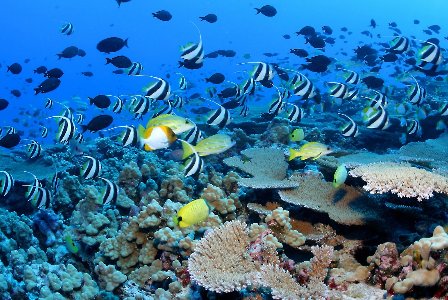 |
Global Solar Atlas (The World Bank Group):Global Solar Atlas (The World Bank Group) World Bank and the International Finance Corporation, collectively The World Bank Group, have provided this Global Solar Atlas in addition to a series of global, regional and country GIS data layers and poster maps, to support the scale-up of solar power. The primary aim of this Global Solar Atlas is to provide quick and easy access to solar resource and photovoltaic power potential data globally, at a click of a mouse. | 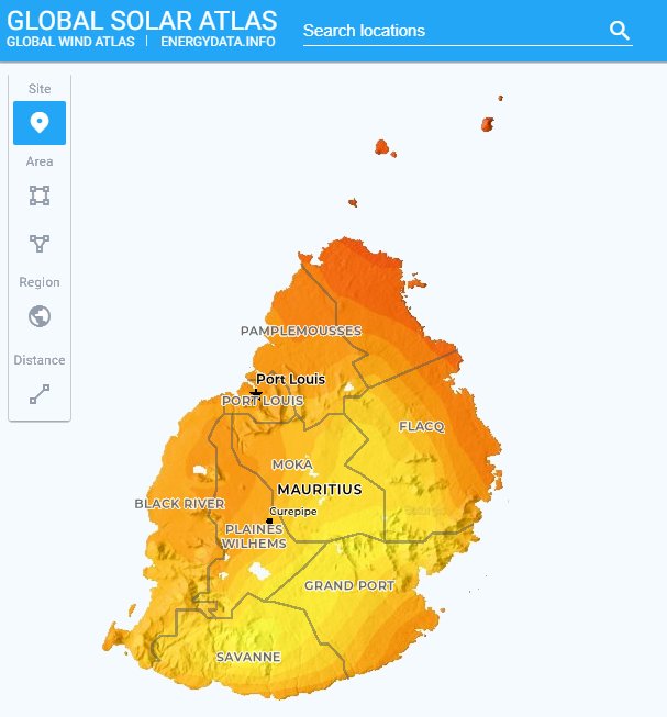 |
Global Wind Atlas (DTU Wind Energy and the World Bank Group)Global Wind Atlas (DTU Wind Energy and the World Bank Group) The Global Wind Atlas is a free, web-based application developed to help policymakers, planners, and investors identify high-wind areas for wind power generation virtually anywhere in the world, and then perform preliminary calculations. The current version of the Global Wind Atlas (GWA 3.3) is the product of a partnership between the Department of Wind Energy at the Technical University of Denmark (DTU Wind Energy) and the World Bank Group (consisting of The World Bank and the International Finance Corporation, or IFC). | 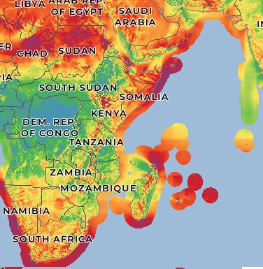 |
IPCC Interactive AtlasA tool for flexible spatial and temporal analyses of much of the observed and projected climate change information underpinning the Working Group I contribution to the Sixth Assessment Report, including regional synthesis for Climatic Impact-Drivers (CIDs). | 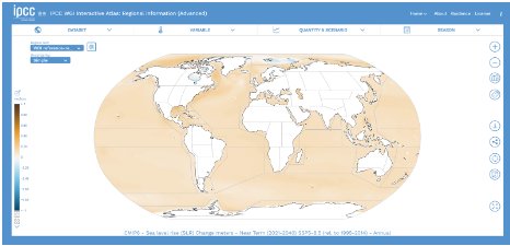 |
Climate TraceEvery day, humanity pumps greenhouse gases into the Earth's atmosphere. Measuring those emissions starts with knowing where they’re coming from and what is causing them. Climate TRACE identifies the locations of large sources and observes them over time. Climate Trace use satellites, other remote sensing techniques, and artificial intelligence to deliver a detailed look at global emissions that gets even better over time. | 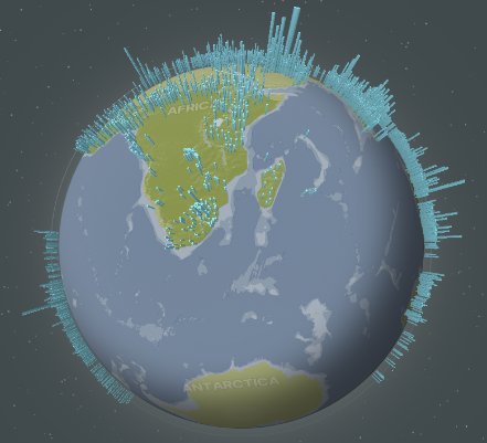 |
MarCOSIO ProjectThe MarCOSIO project aims to maintain, further develop and provide a sustainable platform for local, institutional, human and technical capabilities in the African partner countries that include Namibia, Mozambique, Tanzania, Kenya and South Africa, through the development of services focused on sustainable socio-economic development, empowering a wide range of users in the public and private sectors through the application of regionally-optimised satellite observations and model based forecasts in the South and East African marine and coastal domains. |
These freely accessible links provide key data on temperature, water quality (including turbidity and chlorophyll-a), as well as cloud and vegetation flags. These can be accessed here: |