Astronomical
|
| |
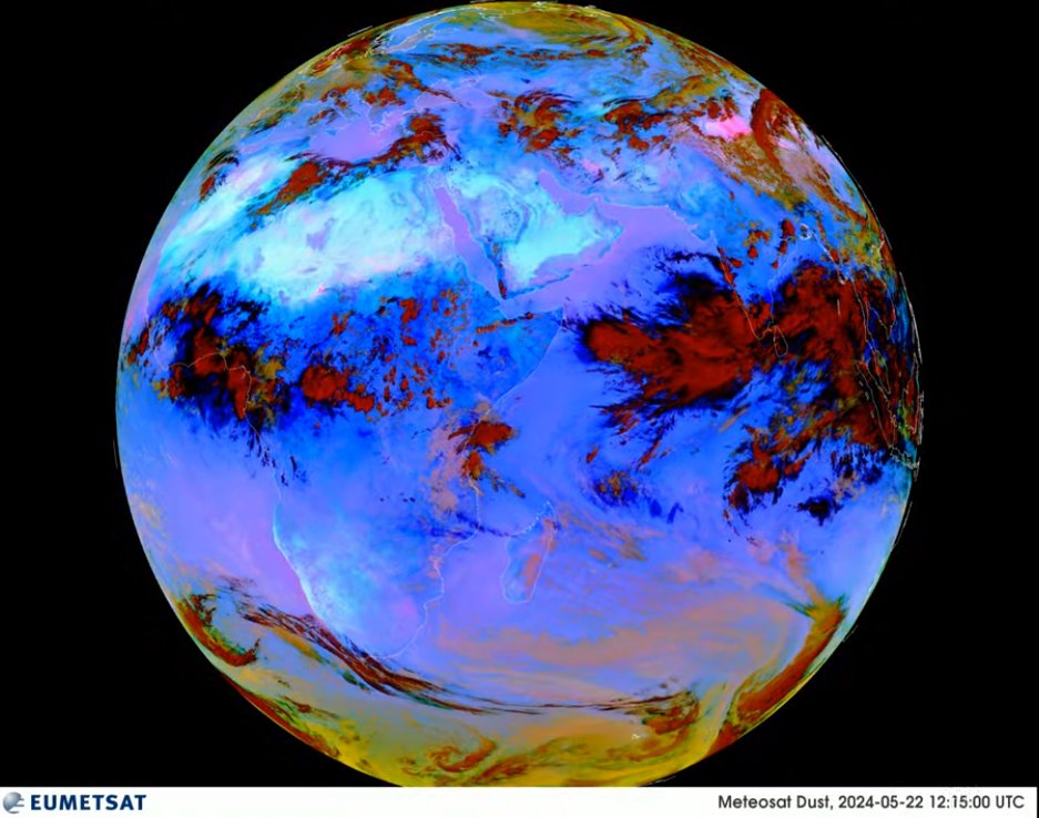
EUMETSATWatch live weather over the Indian Ocean! This real-time imagery is captured by the Meteosat-9 satellite, orbiting 36,000 km above Earth. New images are received every 15 minutes (with a 30-minute processing delay). Meteosat-9 observes weather patterns in 12 different wavelengths, providing detailed information (3 km resolution, with a 1 km high-resolution channel). This data is vital for:
Explore more: Access additional satellite imagery through EUMETView: https://view.eumetsat.int |
Watch live weather over the Indian Ocean! | |
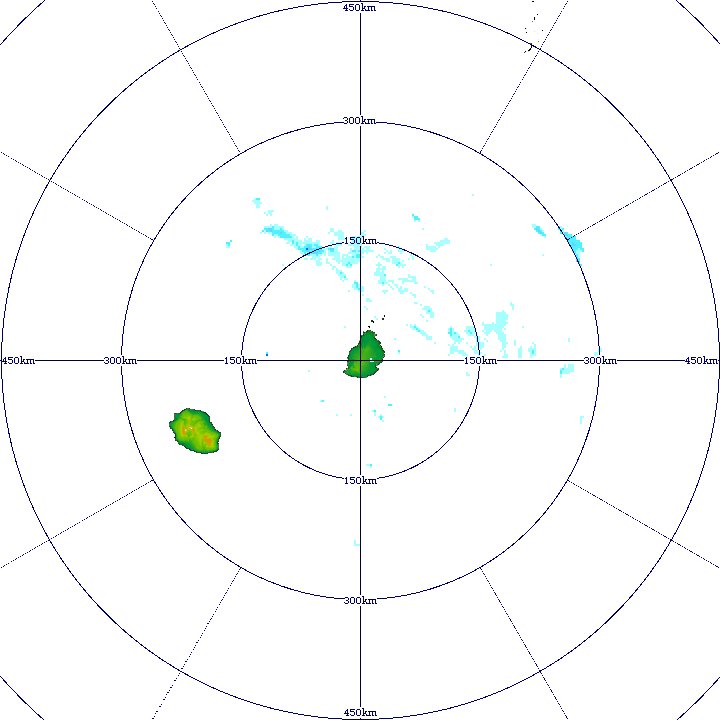
MAURITIUS METEOROLOGICAL RADARThe Mauritius Meteorological Radar Data Display System, offers sophisticated imaging capabilities that play a crucial role in weather monitoring and forecasting. These enhance Mauritius' meteorological services, providing crucial support in its efforts to mitigate the impacts of severe weather and improve public safety?. Key features related to the radar's imagery capabilities include:
|  | |
ZOOM.EARTHZoom Earth is an interactive weather map of the world and a real-time hurricane tracker. Can view live satellite images of storms and wildfires, and explore weather forecast maps of wind, rain, temperature, pressure and more. | 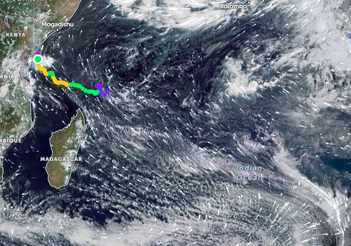 | |
WINDY.COMWindy is a Czech company providing interactive weather forecasting services worldwide. The portal was founded by Ivo Lukaovi in November 2014. Windy provides animations on various essential meteorological parameters, such as wind, temperature, pressure, relative humidity, cloud base, and additional panels featuring more advanced data. | 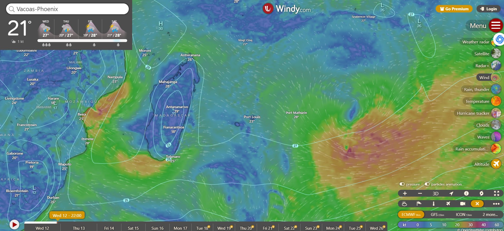 | |
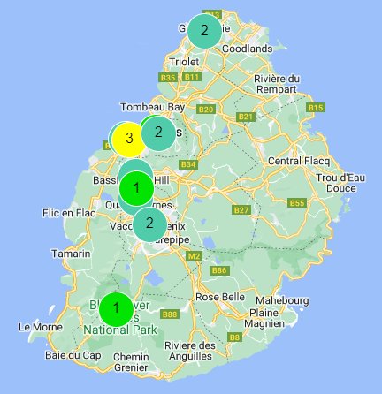
Air QualityIQAir is a Swiss air quality technology company, specializing in protection against airborne pollutants, developing air quality monitoring and air cleaning products. IQAir also operates AirVisual, a real-time air quality information platform. | +IQAir 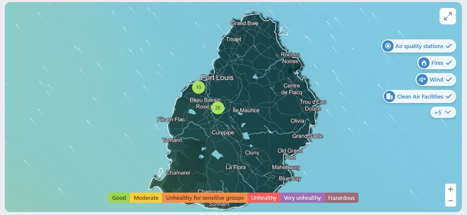 | |
MAURITIUS AIR QUALITY INDEXGoal: Improve air quality and reduce key pollutants according to World Health Organization (WHO) guidelines. Breathing clean air is vital, and air pollutants can harm health and the environment. System Features:
Benefits:
|  | |
MarCOSIO ProjectThe MarCOSIO project aims to maintain, further develop and provide a sustainable platform for local, institutional, human and technical capabilities in the African partner countries that include Namibia, Mozambique, Tanzania, Kenya and South Africa, through the development of services focused on sustainable socio-economic development, empowering a wide range of users in the public and private sectors through the application of regionally-optimised satellite observations and model based forecasts in the South and East African marine and coastal domains. |
These freely accessible links provide key data on temperature, water quality (including turbidity and chlorophyll-a), as well as cloud and vegetation flags. These can be accessed here: | |
LIVE TRAFFIC FLOWIf you’re new to a certain place and don’t know your way around, Google Map gives you traffic information. Roads with green lines indicate that traffic flow is fast while red ones indicate slow traffic. Surveillance cameras monitoring traffic conditions: Traffic Watch | 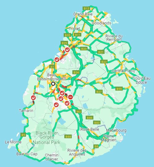 | |
Live MAURITIUS Webcams | ||