
Coastal erosion remains a pressing concern for Mauritius, demanding continued efforts in research, monitoring, and the implementation of effective coastal management strategies. Engaging the community and integrating sustainable practices are vital for preserving the island's coastal zones for future generations.
Coastal erosion in Mauritius is a significant environmental challenge, exacerbated by both natural processes and human activities. The island's coastlines, famous for their beautiful beaches and rich biodiversity, are increasingly threatened by the loss of land to the sea. Factors contributing to coastal erosion include sea-level rise due to climate change, storm surges, the destruction of coral reefs which act as natural barriers, and human activities such as construction and sand mining (banned since 2001).
Impacts of Coastal Erosion | ||
| ||
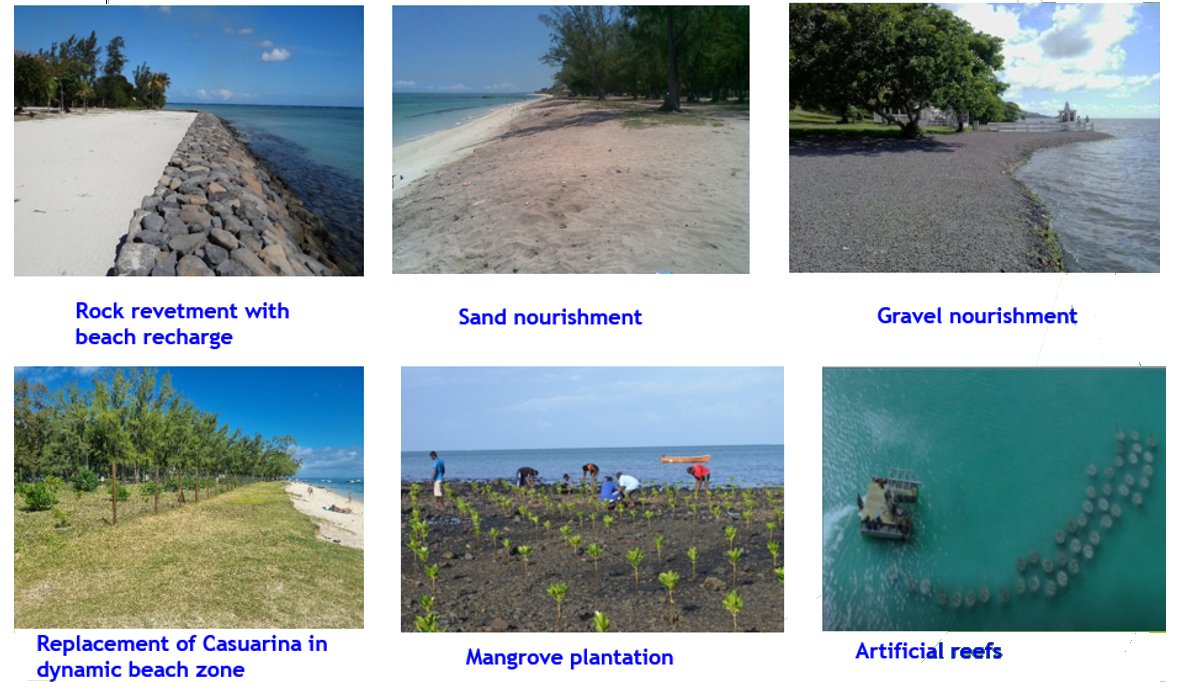
Strategies for Mitigation | ||
|
Sites highly susceptible to erosion | ||
In the short term, the erosion of Mauritius' coasts is primarily caused by intensive coastal development, sea level rise, coral reef degradation, and tropical cyclones, which generate large surges and waves when they pass close to or directly over the island. The national tourism strategy predicts that by the century's end, half of the country’s beaches will be eroded to the extent that they can no longer accommodate visitors, resulting in significant economic losses. Additionally, the loss of coastal areas not only means a loss of habitat for flora and fauna but also exposes previously protected inland areas to direct coastal hazards like storm surges, high tides, and strong winds. | ||
Quatre Soeurs Beach | ||
 | 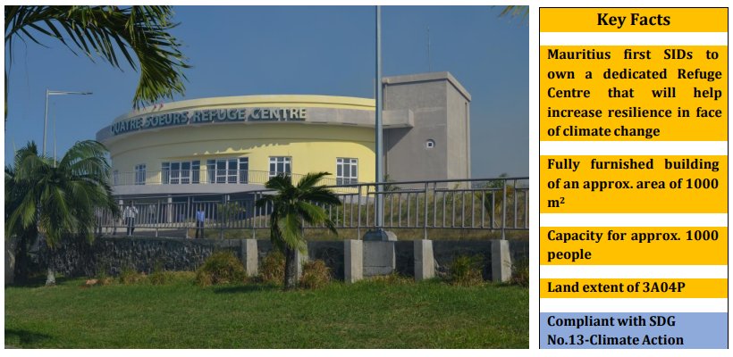 | |
| source: UNDP Adaptation Fund Project, 2012 | ||
Mon Choisy Beach | ||
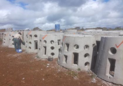
Description: One of the most popular beaches in Mauritius, Mon Choisy has experienced significant erosion over the years. The beach has been visibly reduced in width, impacting both tourism and the natural habitat. Response:
• Restoration efforts include the installation of geotextile tubes and replanting of coastal vegetation to stabilize the shoreline and reduce further erosion. About 950 concrete domes have been placed in rows to form the artificial reef. | 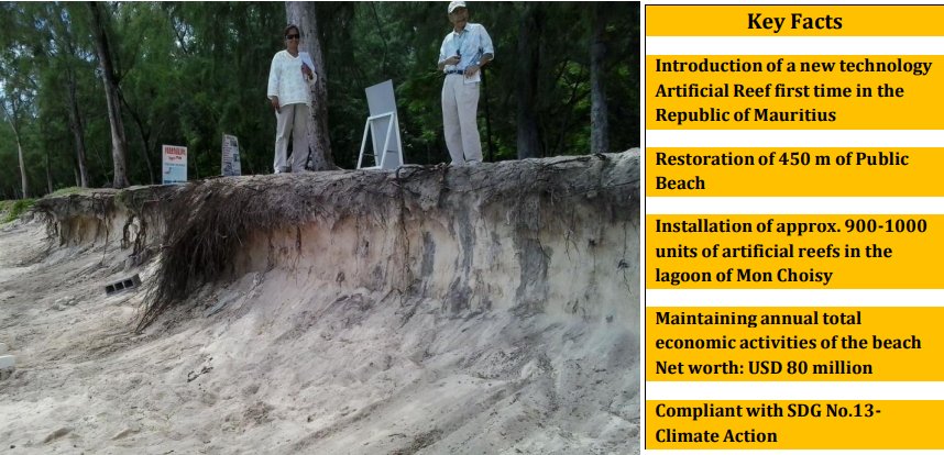 | |
 | ||
Flic en Flac | ||
| ||
Rivière des Galets | ||
• Construction of a Rock Revetment of length of 430 metres | 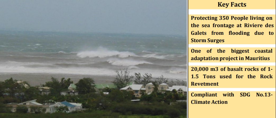 | |
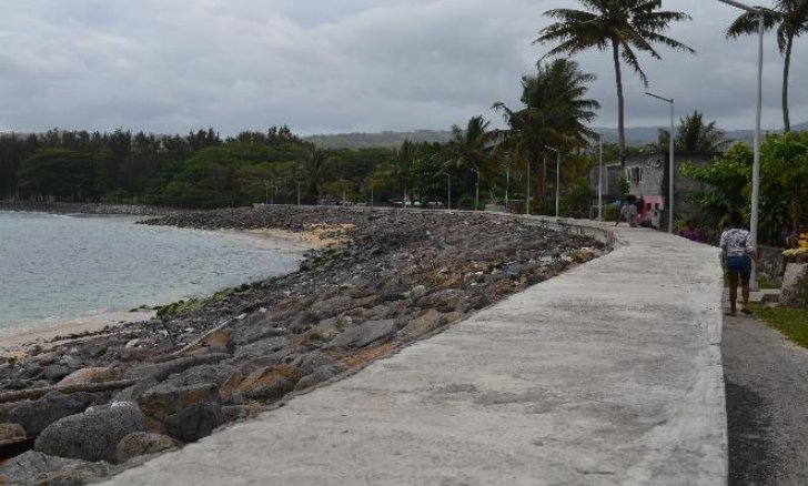 Rock Embankment | ||
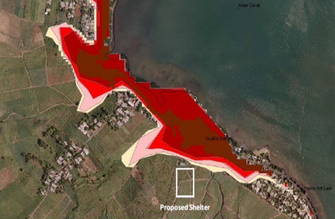
Grand Sable | ||
| Enhancing resilience in the communities of Grand Sable and Quatre Soeurs to address climate change impacts through creation of a mangrove nursery followed by plantation campaigns and the construction of a flash flood drain. | 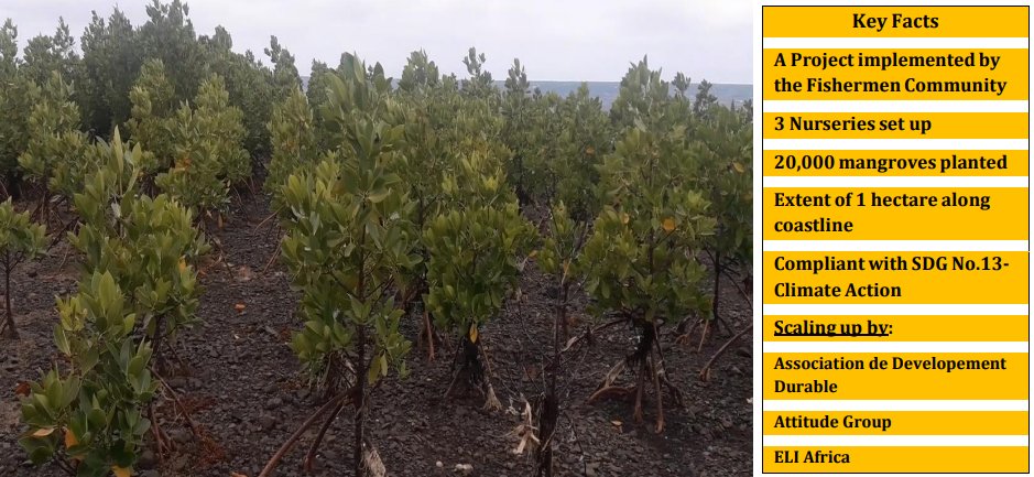 | |
Other Areas which are highly susceptible to erosion include Le Morne, Riambel, Pointe d’Esny, Cap Malheureux, and Grand Bay.
Protection/Rehabilitation of Shoreline using Hard Measures |
The Ministry of Environment has undertaken several projects to address coastal erosion and shoreline restoration. Since 2019, some 5.3km of shoreline has been protected/rehabilitated as follows:
BEFORE | AFTER | |
| 2019 – Grand Baie Sunset Boulevard (100m) | ||
 | ||
| 2019 – Baie Du Tombeau (300m) | ||
 | ||
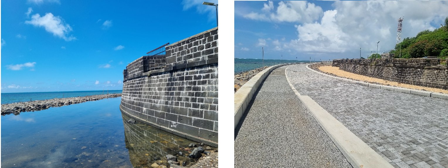
| 2021 – Saint Martin Bel Ombre (260m) | ||
.jpg) | ||
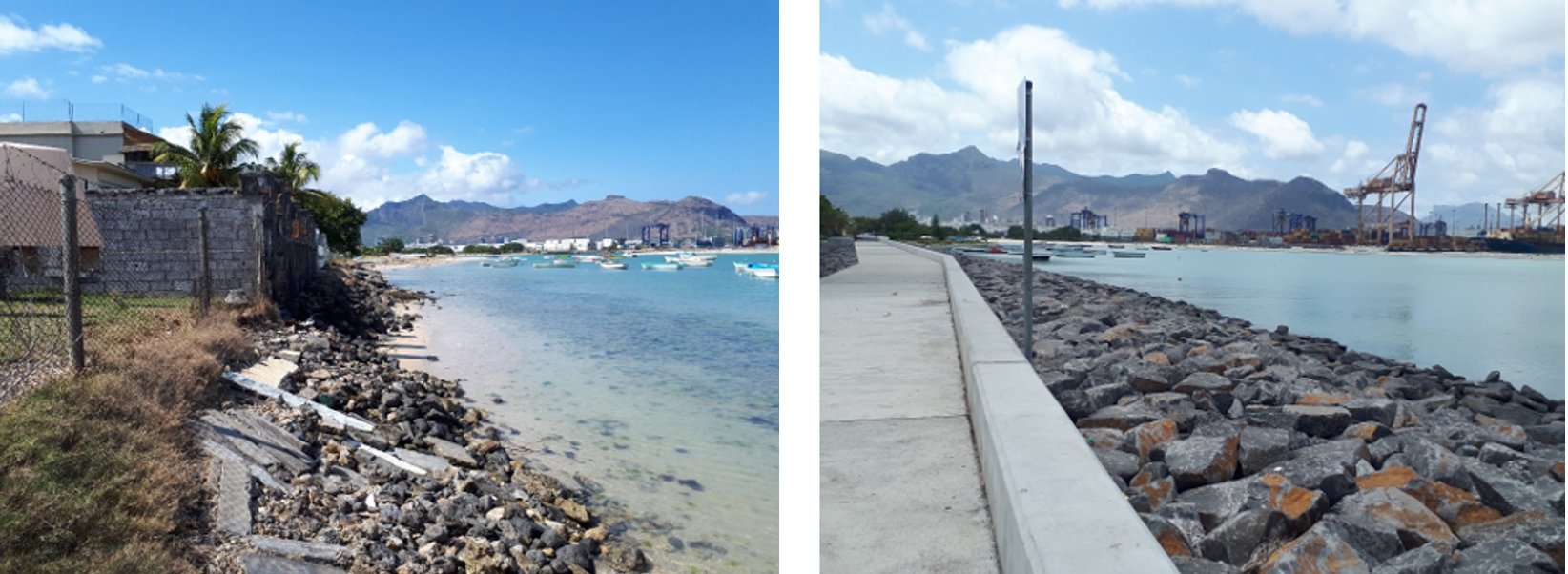
| 2022 – Pointe aux Feuilles to Grand Sable (725m) | ||
.jpg) | ||
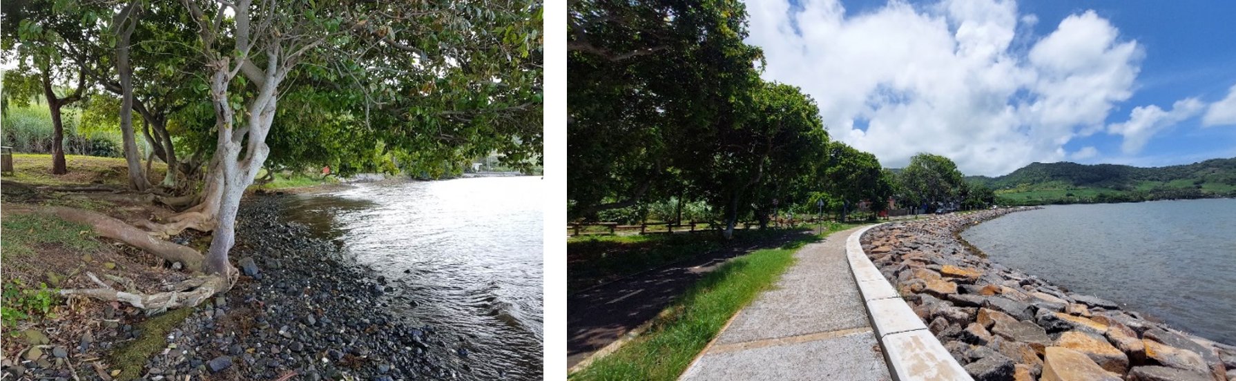
| 2022 – Petit Sable to Bambous Virieux (1.5 km) | ||
 | ||
| 2022 – Providence (1.1km) | ||
 | ||
• Case Noyale – 100m
• Grand Baie Sunset Boulevard – 100m
• St Martin, Baie du Cap – 260m
• Pointe aux Feuilles to Grand Sable – 725m
• Petit Sable to Bambous Virieux – 1500m
• Providence – 1100m
• Bambous Virieux to Anse Jonchée – 1600 m
Protection/Rehabilitation of Shoreline using Soft MeasuresEndemic Trees and Shrubs |
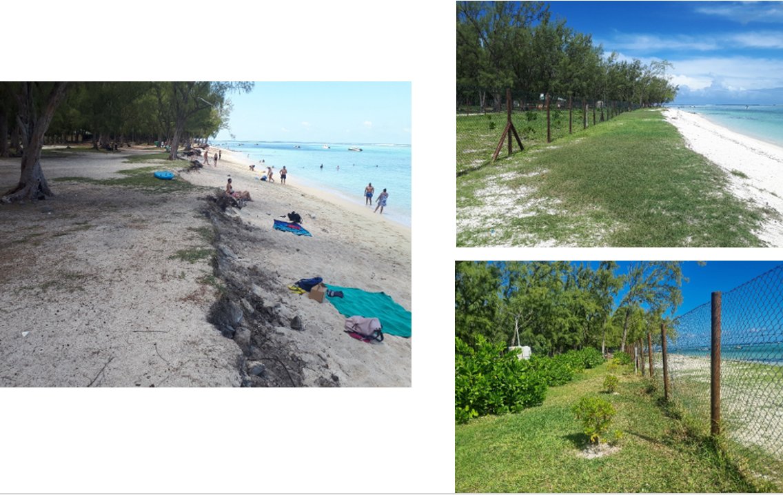
The Ministry of Environment has also replaced casuarina trees (filao trees) by endemic trees and shrubs such as Baume de l’Ile Plate, Veloutiers Vert, Veloutier d’Argent, Bois Boeuf, Bois d’Ebene, Sainte Marie, Badamier and grasses, within the dynamic beach zone for the control of beach erosion, at the following public beaches: Belle Mare (over 400 m), Flic en Flac (over 200m) and Le Morne (over 280m).
BEFORE | AFTER | |
Le Morne Public Beach | ||
 | ||
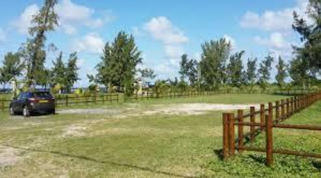
Protection/Rehabilitation of Shoreline using Soft MeasuresSites with Dedicated Vehicle Parking Areas |
A number of sites have restrained parking of vehicles directly on the coast.
Ongoing and Upcoming Projects |