
Rockfalls are a natural hazard in Mauritius that require careful management due to the island's geological and climatic conditions. Through effective planning, engineering, and community engagement, Mauritius can reduce the risks associated with rockfalls and protect its residents and infrastructure.
| Rockfalls represent a significant geohazard in Mauritius, particularly in regions where steep terrain and fractured volcanic rock formations are prevalent. Due to the island's volcanic origin, many areas are susceptible to rockfalls, which pose risks to both human safety and infrastructure. | ||
Causes of RockfallsThe primary causes of rockfalls in Mauritius include natural weathering processes, seismic activities (rare), and heavy rainfall, which can destabilize rock masses on cliff faces and slopes. Human activities such as construction, quarrying, and land clearing also exacerbate the risk by destabilizing already fragile slopes. Consequences of RockfallsRockfalls can lead to loss of life, injury, and damage to property. They can block major roads, isolating communities and disrupting traffic and economic activities. Additionally, rockfalls can damage power lines, water pipes, and other critical infrastructure. Mitigation MeasuresThe Mauritian government and local authorities have implemented several measures to mitigate the impact of rockfalls. These include: Geotechnical Assessments: Regular assessments of rock stability in vulnerable areas to monitor risk. | 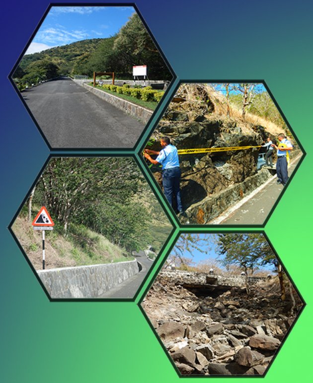 | |
Rockfall Prone AreasRockfalls in Mauritius typically occur in the more mountainous regions, including coastal cliffs. Areas with steep topography near populated regions or critical infrastructure are particularly vulnerable. Rockfalls occurs mostly during and after rainfall in rockfall-prone areas. Reported cases include Signal Mountain, Maconde, Corps de Garde, and many others.
Rockfall Conditions and Warning SystemThe following criteria for the issue of warnings of rockfall to the public apply: The Rockfall Warning SystemThe rockfall warning system consists of three warning stages namely the Watch, Warning and the Termination.
| 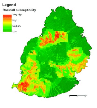 Rockfall susceptibility map (source: Marsala et al, 2019) Landslide Susceptibility Assessment of Mauritius Island (Indian Ocean) | |
Signal MountainStanding at approximately 323 meters, this mountain is one of the most frequented destinations on the island, attracting hundreds of visitors weekly who use its popular health track for physical exercise.  | Maconde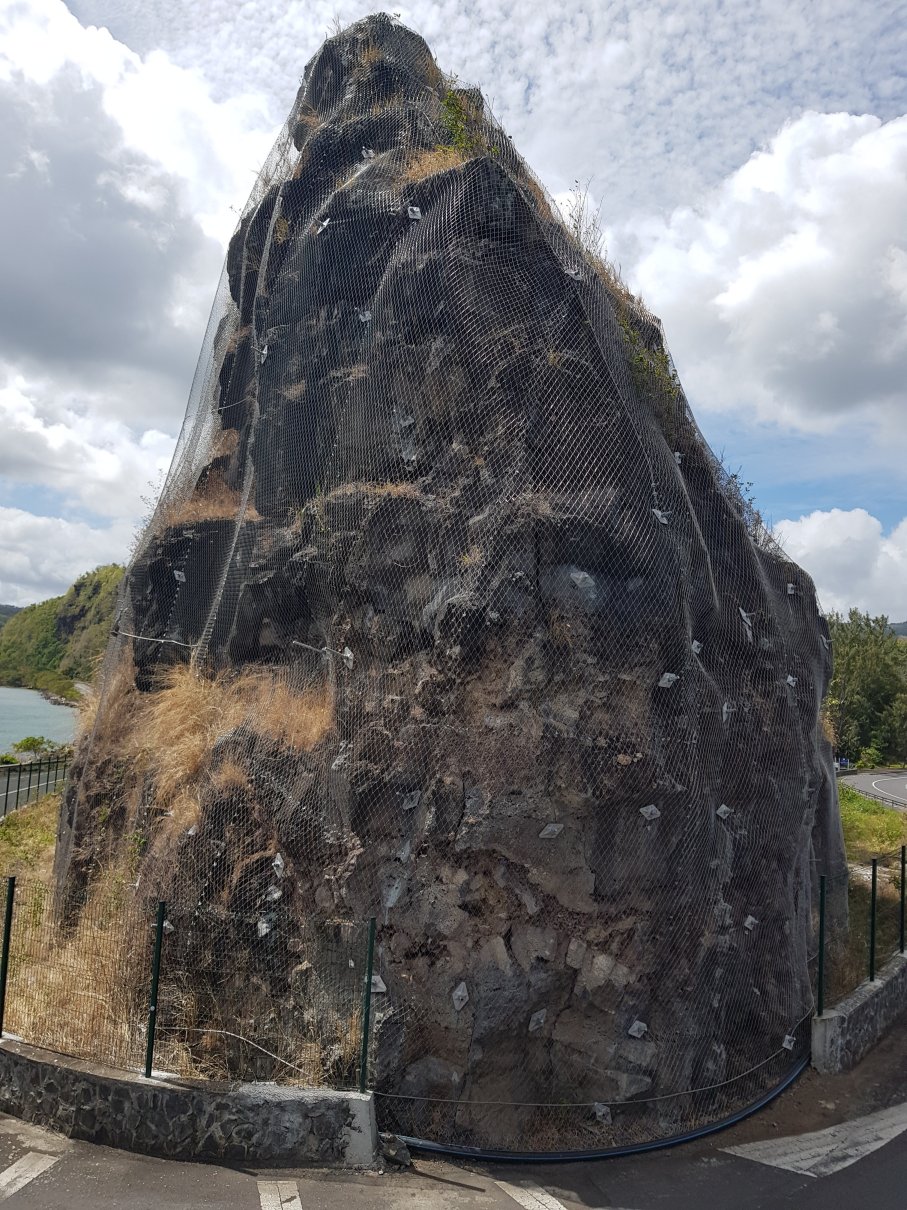 (courtesy: Soonil Rughooputh) | |