
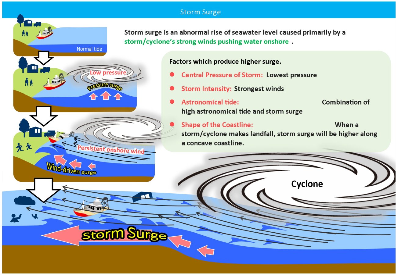
What is a Storm Surge ?Storm surge (maree tempete) is the change in the water level caused by the presence of a storm/cyclone. It is an abnormal rise of water generated by the storm or cyclone, over and above the predicted astronomical tide. Since storm surge is a difference between water levels, it does not have a reference level. In general, storm surge occurs where winds are blowing onshore. The highest surge tends to occur near the “radius of maximum winds,” or where the strongest winds of the hurricane occur. | ||
What is a storm tide?Storm tide (raz de maree) is the water level rise during a storm due to the combination of storm surge and the astronomical tide. Since storm tide is the combination of surge and tide, it does require a reference level. |
Storm Surge WarningStorm surge warning is issued whenever a tropical depression, a moderate tropical storm, a severe tropical storm, a tropical cyclone, an intense tropical cyclone or a very intense tropical cyclone is evolving close to the Island of Mauritius, Rodrigues, Agaléga and St Brandon and may be included in a cyclone warning. |