Origin of Name: From 1546, the archipelago was known as Saint-Brandon (São Brandão) on Portuguese maritime maps.
Alternative Name: Also referred to as Cargados Carajos, which is the closest of the Mauritian dependencies.
Historical Exploitation and Development began in the 18th century with a handful of slaves initiating the development; initially used for guano exploitation and briefly for cotton cultivation in the 1860s. By 1910, a small community of about 100 fishermen was established, despite harsh conditions. In 1927, the Raphaël Fishing Company began commercial operations, marking a significant turn in the archipelago's economic activities. In 1982, the administration of these islets was officially handed over to the OIDC, reinforcing Mauritian sovereignty.
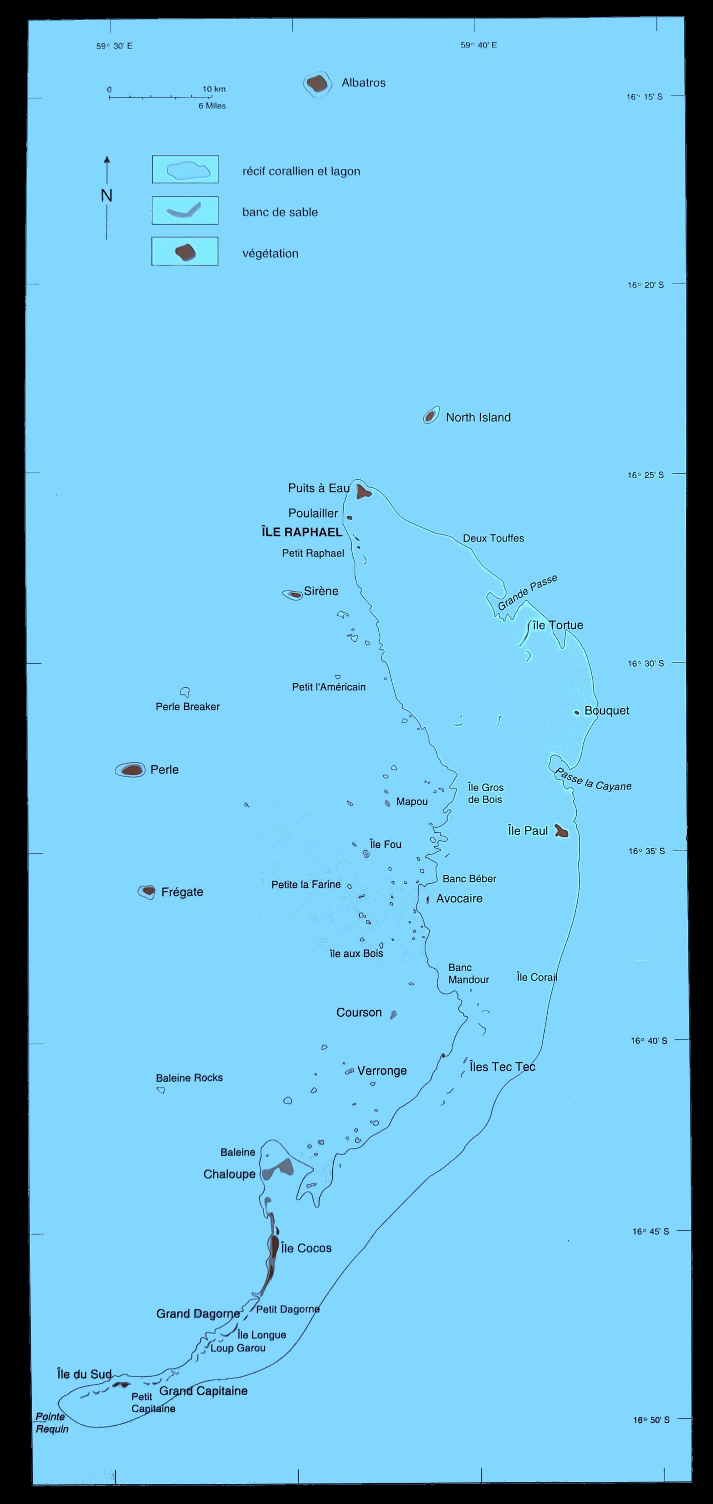
Geographical Setting
Location and Size: It is located about 450 km north/northwest of Mauritius, roughly at 59°35' E longitude, stretching from Albatros at 16°13' S to Pointe Requin at 16°49' S.
Geographical Features: Geographically, the Cargados Carajos archipelago is part of the Mascarene Islands and is situated on the Mascarene Plateau formed by the separation of the Mauritia microcontinent during the separation of India and Madagascar around 60 million years ago from what is today the African continent. The shoals is a group of some 40 islets and is nearly surrounded by coral reefs. It comprises low islets not exceeding 6 m in altitude, coral reefs, shoals, and sand banks arising from a vast submarine platform.
Covers several thousand square kilometers, although the total area of the reef itself does not exceed 190 km².
Total land area of Cargados Carajos is approximately 1.3 km².
Shoal depth: Typically less than 20 m deep.
Main Reef: Crescent-shaped, ~50 km long and 5 km wide, with three passes.
Islets and sand banks and cays: The total number of islands on the reef varies but usually number around 40 depending on seasonal storms, cyclones, and related sand movements.
West side of the crescent: Raphael (main islet), Siren Island, L'île du Sud, Pearl Island, Frigate Island, Avocaré Island, Ile Cocos, Ile du Sud.
North of the crescent:
North Island (about 4 km northeast of the northern tip of the reef.),
Albatross Island, about 18 km north, is geographically a separate single coral island, Grandes Carreaux, and Nazareth banks, known for rich fishing grounds.
Albatross Island is the highest point at 6 m above sea level and the largest of the islands in the group, with an area of 1.01 km² followed by Raphaël, Tortue, Avocaré Island, L'Île Coco and L'île du Sud.
Climate
Tropical maritime climate: The Cargados Carajos Shoals experience a windy tropical maritime climate year-round with an average wind speed of 24 km/h dominated by the south-east trades.
Winter winds: The windiest months occur in winter, with an average wind speed of 30 kilometers per hour.
Temperature: Average summer temperature is 27.4 degrees Celsius, and the average winter temperature is 23.6 degrees Celsius. The seasonal temperature difference is 3.8 degrees Celsius.
Seasonal rainfall: Summer experiences the majority of the rainfall, with 694 millimeters, accounting for 71% of the total annual rainfall. Winter receives only 276 millimeters of rain on average. September, October, and November are the driest months. (Data source: Mauritius Meteorological Services, 2010)
Raphael Island: The long-term average annual rainfall at Raphael Island is 974 mm.
Cyclones can cause considerable damage. In 1948, Il aux Fous disappeared and Avoquer was submerged by two meters of water. Petit ile Longue was swept away in a later cyclone, but is now reappearing.
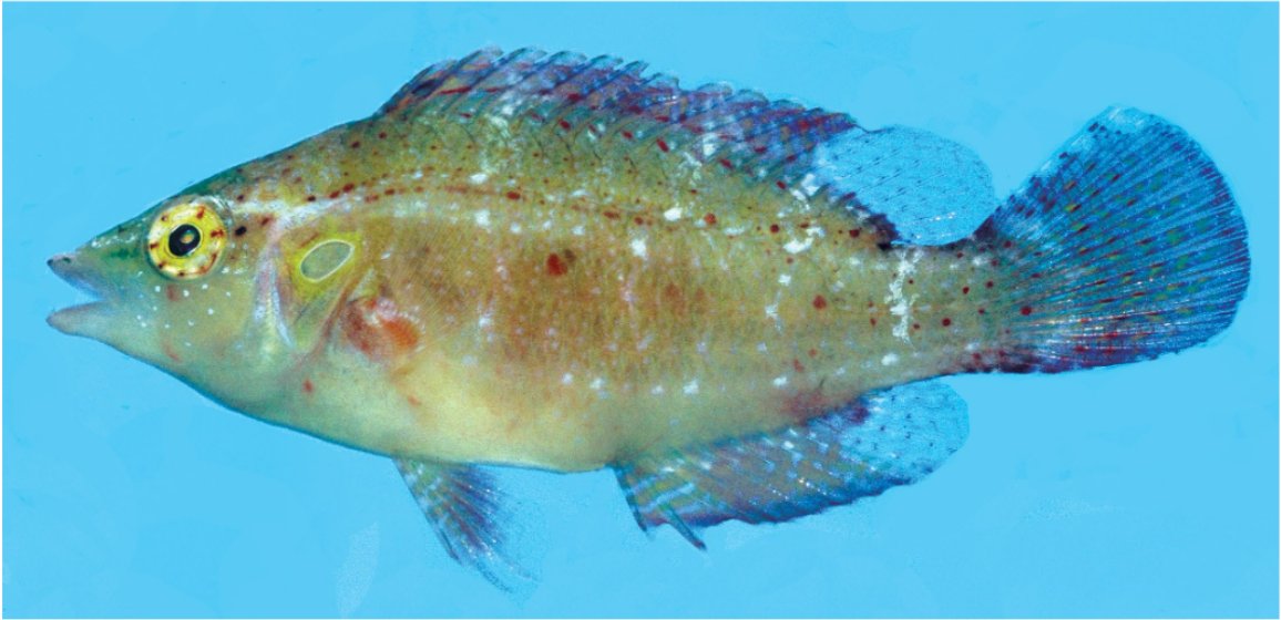
The surrounding waters are rich in turtles, fish, octopuses, and lobsters, forming a critical part of the island's ecosystem and economy. The area boasts a large fish population, green and hawksbill turtles, and the Panulirus lobster. The non-permanent human population is small, consisting mainly of fishermen. Unlike other major fishing areas, the fishing practice here does not have a fixed duration but is quota-based. Fishery production varied between 204 and 594 tonnes from 1977 to 1991, with a significant portion of lobsters and octopuses contributing to the catches in recent years.
Challenges and Ecological Notes
The islands have faced neglect due to their remote location, lack of good land and fresh water, and frequent cyclones. The islands host a variety of bird species but have never experienced significant human settlement.
Fact Sheet: Saint Brandon
General Information:
Alternative Names: Cargados Carajos
Location: Approximately 450 km north/northwest of Mauritius
Geographical Coordinates: Roughly 59°35' E longitude, stretching from 16°13' S (Albatros) to 16°49' S (Pointe Requin)
Total Area: About 1.3 km².
Island Count: Approximately 40 islets
Development and Exploitation:
Fishing Industry Establishment: Early 1830s with a community of about 100 by 1910.
Commercial Exploitation: Started in 1927 by Raphaël Fishing Company, later known as Mauritius Development Ltd.
Ecological and Environmental Aspects:
Marine Life: Rich in turtles, fish, octopuses, and lobsters.
Avifauna: Hosts a variety of bird species, but not densely populated.
Challenges: Frequent cyclones, lack of fresh water, and poor soil quality have historically limited development.
Fishing Practices and Industry:
Fishing Method: Utilizes lines, traps, or seine, similar to artisanal fishing in Mauritius or Rodrigues.
Annual Production Potential: Estimated at 2,000 tonnes
Sustainability: Not overexploited, unique among the Mauritian Economic Exclusive Zone (EEZ) fishing fields.
Governance and Territorial Management:
Administration: Managed by the OIDC since 1982, reinforcing Mauritian territoriality.
Regulations: Turtle capture was banned in 1983, shifting focus to lobsters and octopuses.
Endemic Wildlife and Conservation Efforts
Unique Species: Like many small, remote islands, the Cargados Carajos Shoals boast a high degree of endemism, meaning many plant and animal species found here exist nowhere else on Earth. This unique biodiversity attracts visitors and international conservationists who recognize the critical role these islands play in protecting endangered species.
Sea Turtles: The Cargados Carajos Shoals provide nesting grounds for two endangered sea turtle species:
Green sea turtle (Chelonia mydas): This threatened species finds refuge on the islands' shores.
Critically endangered Hawksbill turtle (Eretmochelys imbricata): The Hawksbill turtle population in the Cargados Carajos Shoals may be genetically distinct from those found further north in the Chagos Islands and Seychelles.
Birdlife and Marine Protection: The islands are designated as a Key Biodiversity Area by the Critical Ecosystem Partnership Fund (CEPF) due to their importance for vulnerable and near-threatened bird species. Recognizing this significance, the World Bank recommended establishing a Marine Protected Area (MPA) in 1998. This recommendation, with some modifications, was adopted by the Mauritian government in 2004, solidifying their commitment to conservation efforts.
Sustainable Practices: The fishing fields of Saint-Brandon are not overexploited, and their annual production potential is estimated at 2,000 tonnes.
Regulatory Measures: In 1983, after banning turtle capture, fishermen shifted focus to lobsters and octopuses, which have increased the economic output.