
According to the FAO: Forests are defined as “Land spanning more than 0.5 hectares with trees higher than 5 meters and a canopy cover of more than 10 percent, which are not primarily under agricultural or urban land use”. Forests cover nearly a third of the Earth's land surface, equivalent to the combined areas of Brazil, Canada, China, and the United States. These 4 billion hectares of forests are not just vast swathes of greenery, but constitute a vital component of almost every facet of life on our planet (UNDP).
see also Forestry Service: | 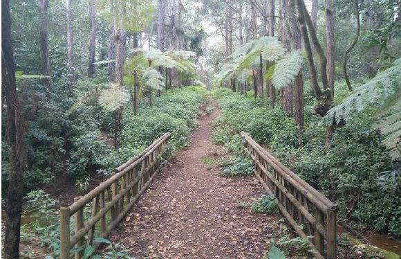  | 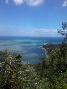 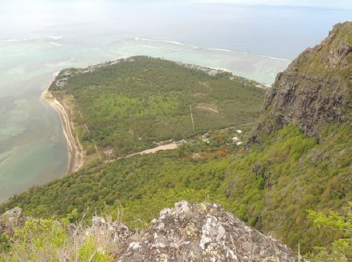 |
Forest Ecosystems | ||
A forest ecosystem is an ecosystem of forests and resources, comprising of abiotic (non-living) and biotic (living) components, including producers, consumers, and decomposers. Soil, animals, insects, microorganisms, and birds are the most important interacting units of a forest ecosystem Forests are large areas predominantly covered with trees and other woody vegetation. They provide a wide range of habitats, microhabitats, and ecological niches for a multitude of species including tall trees, shrubs, and understory vegetation, as well as a rich ecosystem of wildlife, including mammals, birds, amphibians, reptiles, and insects and other organisms. | 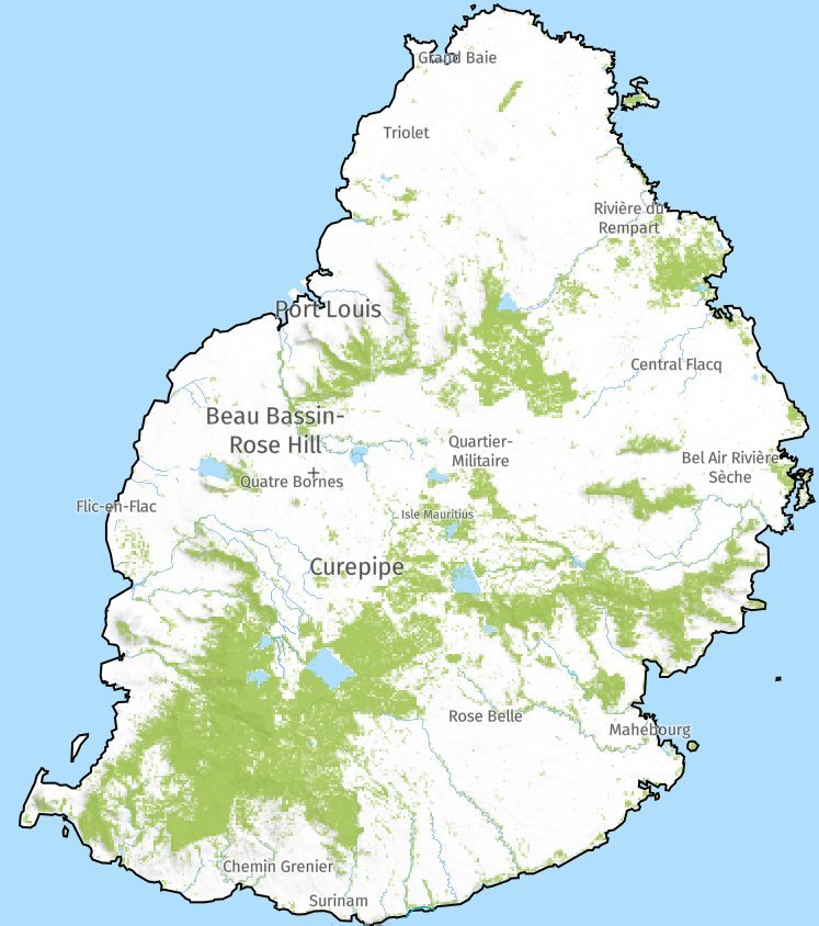   | |
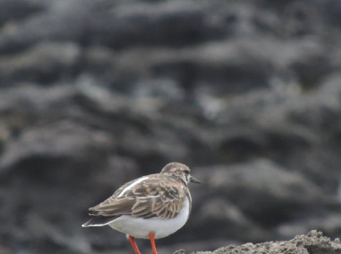
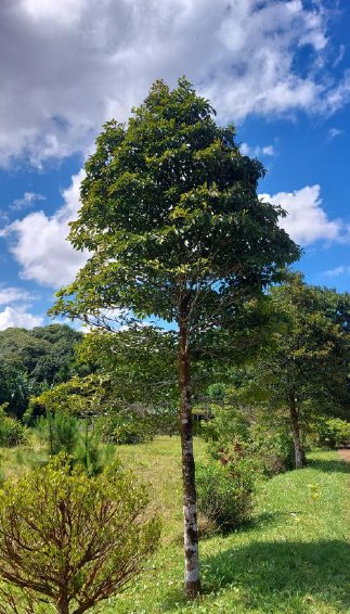
Multifaceted Importance of ForestsOur forests are of immense importance for a variety of ecological, economic, social, and cultural reasons. They play a vital role in safeguarding the delicate ecological balance of the planet by contributing to oxygen production, carbon dioxide absorption, and providing habitats for numerous species. They also play a crucial role in soil and water conservation, and actively contribute to mitigating soil erosion, sequestering carbon, nutrient recycling, preserving biodiversity and genetic resources, and offering opportunities for recreation and ecotourism. Forests provide a multitude of benefits that are crucial for the health of our planet and the well-being of its inhabitants. Beyond their critical role in carbon storage, forests serve as vital shields against extreme weather conditions, such as storms and floods. They are essential in supplying drinking water to nearly half of the world’s largest cities, highlighting their significance in our daily lives- UNEP. Upland forests, located in the major water catchment areas, are regulators of surface run-off, floods and ground water recharge. Coastal forests act as buffers against strong winds and cyclones, and offer natural backdrops to beaches frequented by tourists. Native forests provide habitat for some very rare and endangered plants and birds as well as endemic reptiles and invertebrates. Mangrove forests, where they exist, serve as nurseries and breeding grounds for numerous fish and shellfish, including shrimps. Coastal forests and mangroves also help contain soil erosion and sedimentation of coastal waters. Forest ecosystems are a key component of the global carbon cycle, acting as carbon sinks by sequestering environmental carbon in vegetation and soil components (Kumar et al., 2022). Forests stores around 19% of total carbon stock on the planet (FAO & UNEP, 2020) and about 40% of terrestrial biomass carbon (Qiu et al., 2020). Role of Forests as Migration CorridorsForests often serve as crucial migration corridors for diverse species, allowing them to move between different habitats, find seasonal food sources, and establish genetic diversity. This is especially true for our native forests that have unfortunately been under considerable pressure for many years due to various factors such as deforestation, invasive species, urbanization, and agricultural expansion. These threats have led to habitat loss and degradation, putting our native biodiversity at risk of extinction. Forest Coverage, biodiversity and Management in MauritiusMauritius boasts a diverse heritage of 58 families of indigenous and endemic plants. Its national parks safeguard areas of natural beauty and the island's flora, which includes around 700 plant species, 273 of which are endemic to Mauritius (source: GoM). According to the Forestry Service, the total forest cover in Mauritius in 2024 was approximately 42,000 hectares, accounting for about 22% of the island's total land area. Today, these forests are managed primarily for environmental purposes rather than timber production (source: GoM). In fact, the focus of forest management in the Republic of Mauritius has evolved from timber production to emphasizing essential ecological roles, placing the conservation, protection, and sustainable management of our remaining natural forests on the forefront. From climate change to deforestation, forests face multiple challenges. But, with ingenuity and innovation, we can build a more sustainable planet, with forests leading the way. It is crucial to turn the tide on deforestation and the loss of biodiversity which can be done by conserving and sustainably managing forests and trees within an integrated landscape approach - addressing forestry and food security challenges together- FAO. Some of our planted forests are also used for timber, poles, and small wood production. These functions are now well acknowledged and highly esteemed. In fact, the management of the Republic of Mauritius' forests has shifted its primary focus from timber production to prioritizing these vital environmental functions. Furthermore, the conservation, protection, and sustainable development of our remaining native forests have become paramount objectives within our national policy framework. | ||
Evolution of Forests in Mauritius | ||
Mauritius was formed by volcanic origins 8 millions years ago and before colonisation in the 17th Century, the island was covered with pristine and unique forests that were colonised by plants and animals originating from Madagascar, Africa, Asia, India etc. These species, isolated from their ancestors for millions of years on the island, have evolved into forms distinct from their ancestors and become unique to Mauritius. For example, the ancestor of Bois Tambour- Tambourissa quadrifida originated from Madagascar and is now endemic to the island.
Historical Overview of Deforestation in MauritiusFigure shows population growth and deforestation in Mauritius since colonisation. The figure also includes six historical deforestation maps showing native forests (Vaughan and Wiehe 1937, Page and D’Argent 1997*). Ownership and Management of ForestsForests are either State-owned or Privately-owned. The Forestry Service (FS), under the aegis of the Ministry of Agro-Industry and Food Security, oversees state-owned Forest lands and, although privately-owned, the extent of mountain and river reserves, amounting to some 6,540 ha, is protected under the Forests and Reserves Act of 1983. State-owned forests cover around 52.4% while Privately-owned forests cover around 47.6% of forested land (Source: Forestry Service). These areas are under constant surveillance of this Service and any development on these areas require the approval of the Conservator of Forests. It is important to mention here that the figures for privately-owned lands are crude estimates based on expert knowledge from the Forestry Service. It is important to note that there are no communal forests in Mauritius and no communities/indigenous people living within or dependent on the forests. Because of the rising value of land in Mauritius, private forest owners are more inclined to convert their forestlands to more profitable land use such as ecotourism and housing development. (Source National Forestry Policy). Recent Trends in Forest Land UseDuring the past few years, many privately-owned forest lands have been converted to other land uses, such as residential and infrastructural development and agriculture. This has resulted in a significant decrease in privately-owned forests. However, it is to be noted that deforestation has more likely gradually occurred over a span of the past ten years. (Source: Forestry Service) Observations and Studies on Forest DistributionThe Forestry Service has noted a shifting pattern in forest distribution. While climate change could be a contributing factor, comprehensive studies are required to gain a deeper understanding of these changes. *Page WS and D’Argent G (1997). A vegetation survey of Mauritius. Report Commissioned by IUCN, Basel. Mauritian Wildlife Foundation, Port Louis, Mauritius. | Population growth and Deforestation in Mauritius since colonisation source: Sietze Norder et al. (2017) 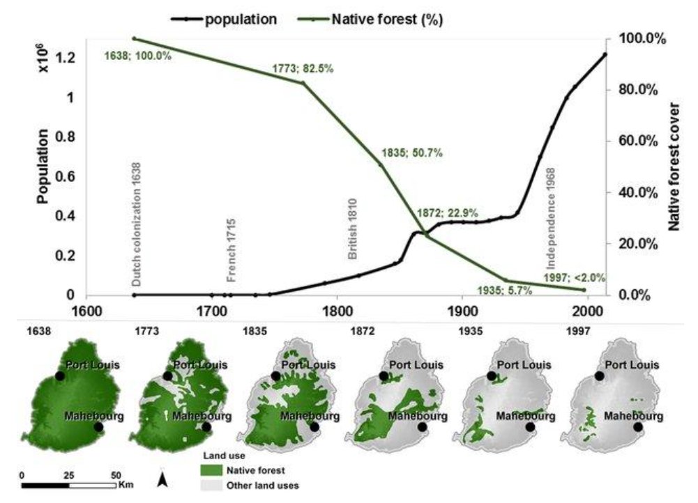 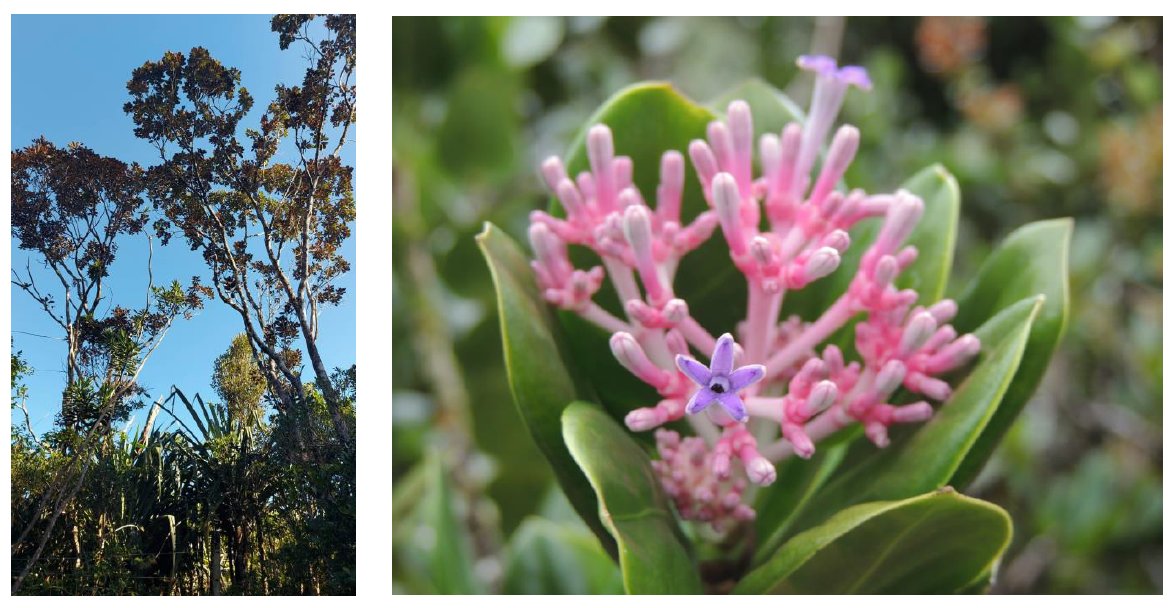 | |
Status as at Dec 2023 | ||
Forest Cover OverviewTotal Forest Cover: Indicates the percentage and area of total forest cover in Mauritius, which is about 22% or approximately 42,000 hectares. Composition of Forest Cover: Details the types of forest cover, including planted forests, shrub-land (14%), and native forests (< 2%). It notes that only about 1% of the native forest is of 'good quality', characterized by more than 50% canopy cover, while 9% is highly degraded. Protected Areas (PA) and Forest ManagementStability of Protected Areas: States that the extent of mainland forest area and protected areas has remained unchanged since 2010. Native Forest Restoration: Reports a significant increase, over 500%, in the area under native forest restoration since 2010 (PAN Project, NPCS, FS). Protected Areas by Ownership: Breaks down the total area of state-owned and privately-owned protected areas, totaling 14,914.5 hectares.
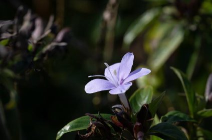
Flora and BiodiversityHeritage of Plant Families: Mentions Mauritius's rich heritage of 58 families of indigenous and endemic plants. National Parks and Endemic Species: Discusses the role of national parks in protecting natural beauty and flora, including about 700 species of plants, 273 of which are endemic to Mauritius. Purpose and Management of ForestsCurrent Management Focus: Indicates that the forests are now managed primarily for environmental functions rather than timber production. | ||
Percentage area of forests by category (2022) [source: SM] | ||
Categorisation of Forests | |||||||
State-Owned ForestsPlantations: Around 54% of the state-owned forest areas. Nature Reserves: Cover 3.6% of the state forest area, including both mainland and islets, protected under the Forests and Reserves Act of 1983 (amended in 1986 and 2003).
National Parks: Protected under the Native Terrestrial Biodiversity & National Parks Act of 2015.
Special Reserves: Comprise 2.3% of the forest area, regulated by Section 11 of the Native Terrestrial Biodiversity & National Parks Act of 2015. "Islet National Parks" , proclaimed in 2004,have been renamed as "Special Reserves" as per the Native Terrestrial Biodiversity & National Parks Act of 2015.
Vallee D'Osterlog Endemic Garden: Covers 0.6% of the area, protected under the Vallée d'Osterlog Endemic Garden Foundation Act of 2007. Ramsar Sites: Designated as wetlands of international importance under the RAMSAR Convention, covering 0.2% of the area.
Other Forest Lands: Comprising 6.0% of the state forest area. Pas Geometriques: These are narrow belts of coastal lands, accounting for 2.7% of the forest area, where change in land use is permitted.
Privately-Owned ForestsReserves: Covering 26.2% of the privately-owned forests, these include mountain reserves (~3800 ha), river reserves (~2740 ha), and small nature reserves (~13 ha), protected under the same Forests and Reserves Act as the state reserves. Other: Making up 73.8% of the private forests, including a mix of plantations, forest lands, scrub, and grazing lands. Note: Although all State-owned lands are protected by law, Pas Geometriques (588 ha) are not considered in the above list since change in land use is allowed thereon. Private Reserves Mondrain (5 ha) and Sir Emile Series (8 ha) are also not included as they are not proclaimed as such under any law. |  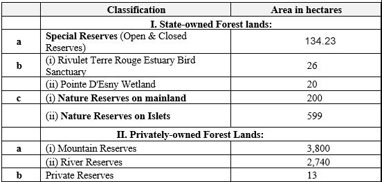 The National Parks and Conservation Service (NPCS) is responsible for the management of our native terrestrial biodiversity and its ecosystem. NPCS has its main headquarters at Réduit, near the Veterinary Service Division of the Ministry for Agro Industry and Food Security. Other outdoor sections of National Parks and Conservation Service include:
NOTE: National Heritage Site: Ile de la Passe (2.19 ha) is protected as per the Ancient Monuments Act of 1944 (updated in 1985); Ile de La Passe is considered as National Heritage Site, not a Special Reserve.
See also:
| ||||||
|  |