
Irrigation Map (Irrigation Authority)
Layers | Water | |
Reservoirs Rivers Lakes CWA cash offices | ||
Layers | Wastewater | |
WMA Infrastructure WMA Treatment Facilities WMA Pumping Stations | ||
| Boreholes | CWA Map - Click HERE (can take time to load) | |
Layers | Rivers, Reservoirs and Watershedssource: Water Resources Commission | |
Rivers Reservoirs Watersheds | 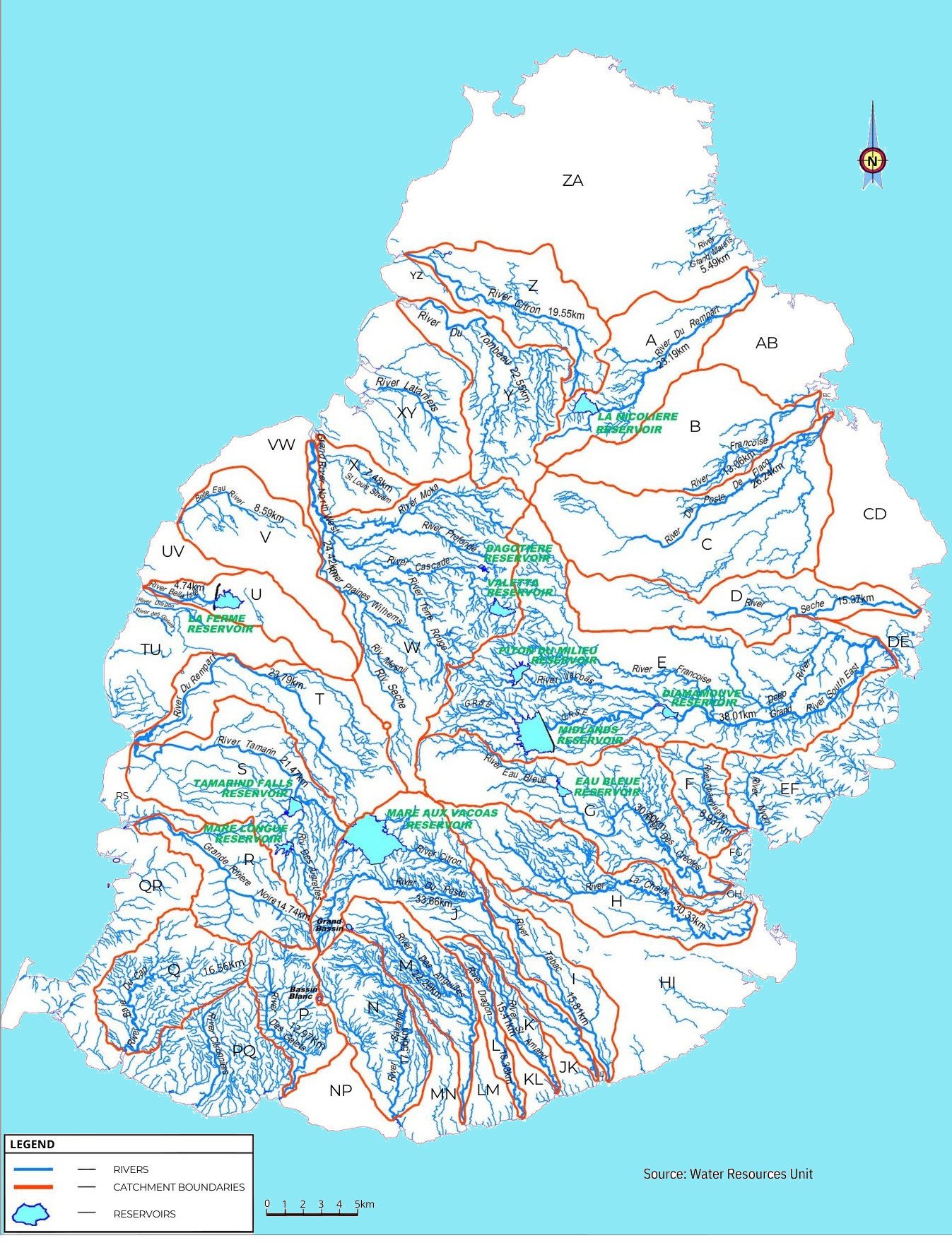 | |
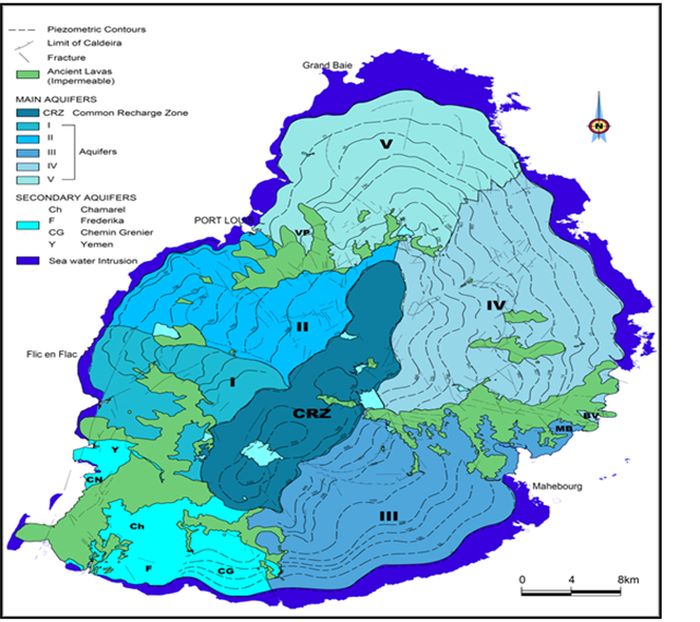
Layers | Aquifers | |
Main Aquifers Secondary Aquifers Ancient Lavas Fractures Limits of Caldeira Piezometric contours |
 |